
Atlas Mountains Morocco: A Breathtaking Destination
Table of Contents
Atlas Mountains Morocco
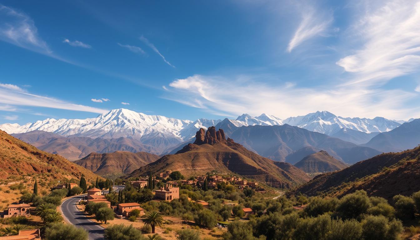
Imagine standing where snow dusts 13,671-foot summits just hours from sun-baked desert plains. This isn’t a fantasy—it’s the reality of North Africa’s largest mountain system, stretching over 1,600 miles through three countries. Few landscapes on Earth blend extremes so dramatically.
These peaks form a natural wall between the Sahara and coastal regions. You’ll find valleys bursting with almond blossoms in spring, while arid plateaus host nomadic herders. The highest point—Toubkal—draws adventurers worldwide, yet many trails remain refreshingly uncrowded.
What makes these mountain ranges extraordinary? They’re not just geological wonders. Berber communities have thrived here for millennia, preserving traditions you can experience firsthand. Picture sharing mint tea in clay homes as the sunset paints jagged ridges gold.
Key Takeaways
- Forms Africa’s longest mountain chain across Morocco, Algeria, and Tunisia
- Creates distinct climate zones between desert and Mediterranean ecosystems
- Home to Mount Toubkal—the continent’s second-highest peak
- Offers diverse trekking routes from beginner-friendly to expert-level
- Hosts ancient Berber villages with vibrant cultural traditions
- Provides stark contrasts between snowy peaks and nearby desert landscapes
Introduction to Atlas Mountains Morocco
The Atlas mountain system carves through North Africa like a stone giant, stretching 1,600 miles across three nations. This natural wall separates Mediterranean breezes from Sahara’s scorching winds, creating ecosystems that shift faster than cloud shadows.
At its heart lies Toubkal—North Africa’s rooftop at 13,671 feet. While adventurers summit its slopes, Berber shepherds below maintain ancient herding routes through valleys painted with walnut groves.
Three geological siblings shape the region:
| Sub-Range | Highest Point | Signature Trait |
|---|---|---|
| High Atlas | Mount Toubkal | Year-round snowfields |
| Middle Atlas | Jbel Bou Naceur | Cedar forests & waterfalls |
| Anti-Atlas | Jbel Aklim | Mars-like rock formations |
These peaks act as nature’s water towers. Winter snowmelt feeds rivers sustaining 8 million people—a lifeline in arid lands. You’ll find Barbary macaques chattering in old-growth forests and nomadic camps where hospitality traditions thrive.
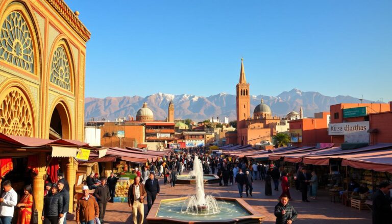
Every switchback trail reveals surprises: cliffside villages clinging to slopes, markets trading saffron and silver, and nights where stars blaze brighter than city lights. It’s where Earth’s raw power meets human ingenuity.
Geology and Formation of the Atlas Mountains
Earth’s crust holds secrets older than dinosaurs here. Three epic construction phases shaped these peaks, each leaving distinct fingerprints in the rock. Your journey through time begins when continents danced closer than today’s map suggests.

Tectonic History and Continental Collision
The first chapter unfolded 300 million years ago. Giant landmasses collided like bumper cars, squeezing the Anti-Atlas range upward. Geologists call this ancient crunch the Alleghenian orogeny – a mashup that once rivaled the Himalayas.
Fast-forward to the age of dinosaurs. The Earth’s crust stretched thin, tearing continents apart. This stretching created fractures that would later become the Atlantic Ocean’s birth certificate.
| Phase | Time Frame | Key Event |
|---|---|---|
| 1 | Paleozoic Era | Continental collision forms Anti-Atlas |
| 2 | Mesozoic Era | Crustal extension creates rift valleys |
| 3 | Cenozoic Era | African-European collision lifts High Atlas |
Erosion, Weathering, and Glacial Influences
Nature’s sculptors went to work once the peaks rose. Ice Age glaciers carved bowl-shaped cirques, while rivers etched canyons deeper than skyscrapers. “These mountains are geological palimpsests,” notes geologist Dr. Amina Belkahia. “Each layer tells a different climate story.”
Wind and rain continue reshaping the ranges today. Seasonal snowmelt feeds oasis valleys, proving how geological processes directly sustain life. You can literally watch erosion in action during spring floods.
Over 100 million years of weathering created the dramatic vistas hikers cherish. Those red sandstone cliffs? They’re Earth’s history books written in iron oxide.
The Diverse Ranges: Anti-Atlas, High Atlas, and Middle Atlas
Three distinct personalities emerge across these rocky realms. The Anti-Atlas whispers tales of ancient earth, while the High Atlas shouts alpine grandeur. Between them, the Middle Atlas hums with forested tranquility.
Unique Landscape Features
Southwest regions reveal the Anti-Atlas’s lunar beauty. Rust-colored cliffs frame valleys where nomads trace paths between silver deposits. “This range feels like walking through geological time,” remarks mountain guide Hassan Zafrani. High Atlas slopes tell a different story – snowmelt creates emerald terraces where walnut trees thrive.
The Middle Atlas surprises with misty cedar groves sheltering Barbary macaques. Its higher rainfall nurtures ecosystems unseen in drier zones. Each range crafts microclimates that shape local lifestyles.
Notable Peaks and Scenic Vistas
Toubkal’s 13,671-foot crown dominates the High Atlas range, drawing peak-baggers year-round. Neighbor Ighil m’Goun offers quieter trails with equal drama. In the Anti-Atlas, Djebel Siroua’s volcanic cone rewards hikers with Sahara views.
Middle Atlas reveals gentler wonders – Jbel Bou Naceur’s slopes bloom with wildflowers each spring. Whether chasing summits or soaking in valley panoramas, these elevations deliver unforgettable moments.
Exploring Tell Atlas, Aurès Mountains, and Saharan Atlas
Discover the lesser-known siblings of North Africa’s iconic mountain system. While the High Atlas commands attention, these eastern ranges shape ecosystems and cultures across three nations. Their stories unfold through shifting climates and resilient communities.

Geographical Distribution and Character
The Tell Atlas stretches like a green ribbon along the Mediterranean coast. Over 1,500 kilometers long, it catches moist sea winds that drench its slopes. Winter transforms Lalla Khadidja’s 2,308-meter summit into a snow-capped sentinel watching over Algeria.
Eastward, the Aurès Mountains rise as natural fortresses. Berber tribes here once repelled Roman legions, their cliffside villages still guarding ancient traditions. “These peaks aren’t just rock—they’re living history books,” says Algerian trekking guide Farid Belkacem.
| Range | Highest Peak | Key Feature |
|---|---|---|
| Tell Atlas | Lalla Khadidja | Mediterranean rainfall |
| Aurès | Djebel Chélia | Historical resistance sites |
| Saharan Atlas | Djebel Aissa | Desert transition zone |
The Saharan Atlas performs a magic trick—one side green with juniper forests, the other melting into orange dunes. Its 2,236-meter peaks mark where the Sahara begins, creating microclimates that nurture rare species like the endangered Barbary leopard.
Together, these ranges form nature’s climate control system. They redirect weather patterns, store precious water in limestone aquifers, and host ecosystems found nowhere else on Earth. Your journey through them reveals how geography writes human destiny.
Trekking and Hiking Adventures
Your boots crunch on scree slopes as thin air sharpens every breath. This landscape rewards those who embrace vertical challenges, with routes ranging from sunrise strolls through walnut groves to summit pushes testing human limits.
Challenges of Mount Toubkal and Surrounding Trails
Conquering North Africa’s highest peak demands respect. The Mount Toubkal ascent throws 4,167 meters of elevation gain at you across two grueling days. “It’s not just altitude that bites,” warns local guide Rashid Ait-Ben-Haddou. “Sudden weather shifts turn scree into ice rinks.”
Acclimatization proves crucial—headaches and nausea plague unprepared hikers. You’ll navigate switchbacks, boulder fields, and final summit scrambles requiring steady footing. Most groups start pre-dawn to avoid afternoon storms.
Day Hikes vs. Multi-Day Treks
Short on time? The Three Valleys route packs waterfalls, Berber hamlets, and 2,800-meter passes into three days. You’ll sleep in village guesthouses feasting on tagine under starry skies.
For deeper immersion, the Five-Day Circuit reveals hidden gorges and nomadic camps. Each dawn brings new peaks to conquer, with pack mules carrying gear between remote refuges. Choose wisely—these trails demand 5-12 hours daily.
| Trek Type | Duration | Daily Hours | Elevation |
|---|---|---|---|
| Summit Push | 2 days | 10-12 | 4,167m |
| Valley Explorer | 3 days | 5-7 | 2,400m |
| Cultural Immersion | 5 days | 6-8 | 2,500m |
Base yourself in Imlil—a hub where gear shops rent ice axes and mint tea flows freely. Whether chasing personal records or cultural connections, these trails transform visitors into storytellers.
Discovering Traditional Berber Villages
Step into a world where time moves to the rhythm of grinding grain and children’s laughter echoing through walnut groves. The Berber villages clinging to rocky slopes offer more than postcard views—they’re living museums of resilience.
Where Hospitality Becomes Family
You’ll quickly learn sharing mint tea isn’t just custom—it’s sacred. Traditional Berber communities measure wealth in relationships, not dirhams. Families in Imlil might invite you to knead dough for communal ovens, while Ouirgane hosts often share stories over saffron-infused tagines.
Flavors Forged by the Land
Meals become cultural lessons here. Taste clay-pot stews simmered with homegrown vegetables, or crack warm bread from earthen ovens. Every bite connects you to generations who’ve farmed these terraced fields using ancient irrigation methods.
Witness women weaving stories into rugs using techniques older than written language. Watch children tend goats while reciting ancestral proverbs. These villages don’t just preserve history—they breathe it daily, inviting you to become part of their ongoing story.


One Comment